

On Monday, May 6, 2024, during the late evening and into the early morning hours of May 7th, a shortwave trough and its associated cold front moved through the western Ozarks region. Showers and thunderstorms developed along the cold front (west of the Ozarks) before rapidly intensifying into a linear storm mode. As the storm line swept through the region, it produced widespread wind damage, flash flooding, and multiple tornadoes. According to the NWS Springfield, MO, “this line of thunderstorms produced straight wind gusts of 60 to 70 mph in addition to five tornadoes (2 EF-1 and 3 EF-0).”
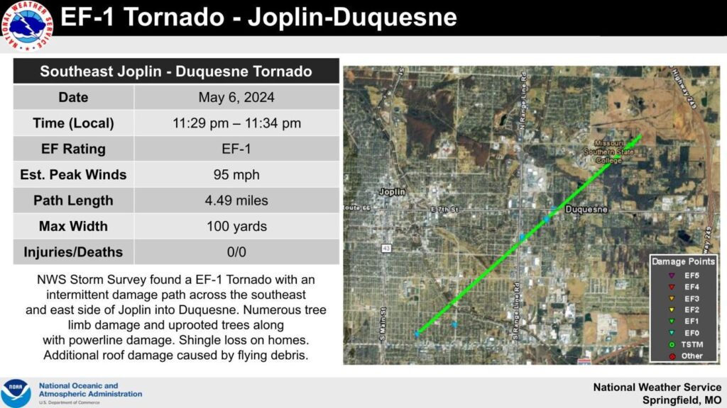
On Wednesday, May 8th another wave of severe thunderstorms swept through the area bringing large hail, damaging wind gusts, and an EF-1 tornado. At Joplin, MO a later NWS confirmed EF-1 tornado occurred in the city limits that touched down just southeast of 26th and Main Street moving northeast, crossing near the 20th Street and Connecticut Avenue intersection, crossing near 10th Street and Range Line Road intersection, and crossing just north of the 7th Street and Duquesne Road intersection. There was intermittent damage across the southeast and east sides of Joplin and into the village of Duquesne. The peak winds were estimated at 95 mph. The tornado caused numerous downed tree limbs, uprooted trees, damage to signs, and damage to power lines. Additional tornadoes were confirmed southeast of Monett, MO in northern Barry County, tracking northeast into southern Lawrence County before dissipating southeast of Aurora, MO.
Resource: NWS Springfield, MO
